The Chapada Diamantina National Park is a 1,520 km² national park in the Chapada Diamantina region of the State of Bahia, Northeast Brazil. The park is about 400 kilometres inland from Salvador, the capital city of Bahia. Chapada is a Brazilian word that means a region of steep cliffs, usually at the edge of a plateau. Diamantina refers to the diamonds found there in the mid-19th century. The geographical center of Bahia is the Diamantina Tableland region. In this mountainous region with a diversified topography, 90% of the rivers of the Paraguaçu, Jacuípe and Rio das Contas basins have their source here. There are thousands of kilometers of clear waters that spring from these mountains and descend in cascades and waterfalls to plateaus and plains, forming beautiful natural pools. The vegetation mixes cactus species of the caatinga dry lands with rare examples of the mountain flora, especially bromeliads, orchids and "sempre vivas" (member of the strawflower family). On the area one can find the three highest mountains in the state: Pico do Barbado, 2,080 m high, Pico Itobira, 1,970 m, and Pico das Almas, 1,958 m. Another scenic attraction is the Cachoeira da Fumaça (Waterfall), that falls 420 m, the Gruta dos Brejões, the largest cavern opening of Bahia, and the amazing Poço Encantado, which fascinates visitors to the region. There are so many natural attractions that it is possible to choose between subterranean routes in caves, or trip to waterfalls, trek along old gold mining trails or follow the steps of the Prestes Column, rappel, climb mountains, or go horseback riding in the Vale do Capão or Vale do Paty, in the midst of esoteric and alternative communities. Many of the sites are protected by the National Park of Diamantina Tableland region and the Environmental Preservation Area Serra do Barbado and Marimbus, Iraquara. There are opportunities to take long bikes, or travel on horseback, mountain bike or off-road vehicles.
The Leshan Giant Buddha was built during the Tang Dynasty (618–907AD). It is carved out of a cliff face that lies at the confluence of the Minjiang, Dadu and Qingyi rivers in the southern part of Sichuan province in China, near the city of Leshan. The stone sculpture faces Mount Emei, with the rivers flowing below his feet. It is the largest stone Buddha in the world[1] and it is by far the tallest pre-modern statue in the world. The Mount Emei Scenic Area, including Leshan Giant Buddha Scenic Area has been listed as a UNESCO World Heritage Site since 1996. It was not damaged by the 2008 Sichuan earthquake.
Antelope Canyon is the most-visited and most-photographed slot canyon in the American Southwest. It is located on Navajo land near Page, Arizona. Antelope Canyon includes two separate, photogenic slot canyon sections, referred to individually as Upper Antelope Canyon or The Crack; and Lower Antelope Canyon or The Corkscrew. The Navajo name for Upper Antelope Canyon is Tsé bighánílíní, which means "the place where water runs through rocks." Lower Antelope Canyon is Hazdistazí (advertised as "Hasdestwazi" by the Navajo Parks and Recreation Department), or "spiral rock arches." Both are located within the LeChee Chapter of the Navajo Nation.
The St. Regis Bora Bora Resort certainly lives up to travelers' expectations that the brand is all about the ultimate in good taste and luxury: The property, which opened in 2006, features not only one of Bora Bora's best beaches and its largest overwater bungalows, but also Lagoon, the region's only restaurant by world-renowned Chef Jean-Georges Vongerichten. While the St. Regis hits all the right notes when it comes to five-star amenities (including butler service), it doesn't quite exude the authentic Polynesian ambiance and cheery "ia ora na" (the local greeting) ease of some of its competitors.
Aside from the thatched roofs, its luxurious bungalows feature décor that's more contemporary than culture-centric, and its lobby, spa and other main buildings have white coral and stone walls with polished marble floors and formal, European-style furnishings. Don't get me wrong: The effect is quite beautiful, but at times a tad out of sync with Bora Bora's natural surroundings. Even so, guests who want to be pampered in high style, will find much to love about this expansive and lushly landscaped resort. Plus, it's fun to be able to tell your friends you stayed at the property that doubled as the "Eden Resort" in the 2008 Vince Vaughn-Jon Favreau comedy "Couples Retreat,"; one the top movies filmed in the South Pacific.
It's easy to keep active and yet refreshed on this 44-acre property, which features two pools: the main pool adjacent to the beach and an intimate Oasis Pool nestled on one of the motus lined with bungalows. But the prime locale for cooling off while having fun is the Lagoonarium, a large, calm salt-water lagoon stocked with fish and ideal for even inexperienced snorkelers, which is accessed via several wooden docks with ladders.
The resort also features complimentary bikes, tennis courts and a fitness center, as well as access to Jet Skis and other lagoon excursions at an added cost. To keep connected, St. Regis offers resort-wide WiFi at a charge of about $30 a day.
While not the largest or most visually impressive spa on the island, the resorts' Miri Miri Spa, set away from everything at the far edge of the Lagoonarium, does offer a wonderfully revitalizing, sigh-inducing Polynesian massage; afterward, you can relax on a chaise or shaded hammock overlooking tranquil blue water as you contemplate all the ways to indulge yourself at this haven of all things luxurious. Source
Villnöß is a municipality in South Tyrol in northern Italy, located about 30 km northeast of the city of Bolzano. The emblem represents three piles of argent on azure, the three peaks symbolize the Odle Group in the head to the Valley of Funes. The emblem was adopted in 1967. South Tyrol is located at the northernmost point in Italy. The province is bordered by Austria to the east and north, specifically by the Austrian federal-states Tyrol and Salzburg, and by the Swiss canton of Graubünden to the west. The Italian provinces of Trento, Belluno, and Sondrio border to the southeast, south, and southwest, respectively.
The landscape itself is mostly cultivated with different types of shrubs and forests and is highly mountainous.
Entirely located in the Alps, the province's landscape is dominated by mountains. The highest peak is the Ortler (3,905 m) in the far west, which is also the highest peak in the Eastern Alps outside the Bernina range. Even more famous are the craggy peaks of the Dolomites in the eastern part of the region. The following mountain groups are in South Tyrol. All but the Sarntal Alps are on the border with Austria, Switzerland, or other Italian provinces. The ranges are clockwise from the west and for each the highest peak is given that is within the province or on its border.
Climatically South Tyrol may be divided into five distinct groups. The Etsch valley area, with cold winters (24-h averages in January of about 0°C) and warm summers (24-h averages in July of about 23°C), usually classified as Humid subtropical climate C fa. It is the driest and sunniest climate of the province. The main city in this area is Bolzano.
The midlands between 300 and 900 metres, with cold winters (24-h averages in January between -3°C and 1°C) and mild summers (24-h averages in July between 15°C and 21°C); This is a typical Oceanic climate, classified as C fb. It is usually wetter than the subtropical climate, and very snowy during the winters. During the spring and autumn, there is a large foggy season, but fog may occur even on summer mornings. Main towns in this area are Merano, Bruneck, Sterzing, Brixen.
Near the lakes in higher lands (between 1000 and 1400 meters) the humidity may make the climate in these regions milder during winter, but also cooler in summer, then, a Subpolar oceanic climate, C fc, may occur.
The alpine valleys between 900 and 1400 metres, with a typically Humid continental climate D fb, covering the largest part of the province. The winters are usually very cold (24-h averages in January between -8°C and -3°C), and the summers, mild with averages between 14 and 19°C. It is a very snowy climate; snow may occur from early October to April or even May. Main municipalities in this area are Urtijëi, Badia, Sexten, Toblach, Stilfs, Vöran, Mühlwald. wiki
Myra was a leading city of the Lycian Union and surpassed Xanthos in early Byzantine times to become the capital city of Lycia. Its remains are situated about 1.5 km north of today's Demre, on the Kaş-Finike road. Most of the ancient city is now covered by Demre and alluvial silts, for it is located on the river Demre Cay in a fertile alluvial plain. Today this large plain is almost covered with greenhouses stuffed full of tomatoes. In ancient times this area was probably farmed extensively, for export and trade with the interior of Lycia.
The date of Myra's foundation is unknown. There is no literary mention of it before the 1st century BC, when it is said to be one of the six leading cities of the Lycian Union (the other five were Xanthos, Tlos, Pinara, Patara and Olympos). It is believed to date back much further however, as an outer defensive wall has been dated to the 5th century BC.
The city is well known for its amphitheatre (the largest in Lycia) and the plethora of rock-cut tombs carved in the cliff above the theatre.
The origin of Myra's name is uncertain and may be a modified form of a Lycian name, like Tlos and Patara. The name was popularly associated with the Greek name for myrrh and the emperor Constantine Porphrogenitus describled the city as "Thrice blessed, myrrh-breathing city of the Lycians, where the mighty Nicolaus, servant of God, spouts forth myrrh in accordance with the city's name." However, Myra does not seem to be known for its production of myrrh, the only product actually recorded is rue.
Myra once had a great temple of the goddess Artemis Eleuthera (a distinctive form of Cybele, the ancient mother goddess of Anatolia), said to be Lycia's largest and most splendid building. It was built on large grounds with beautiful gardens and had an inner court defined by columns, an altar and a statue of the goddess. Not a trace of it remains today, however, since St. Nicholas (the bishop of Myra in the 4th century AD) in his zeal to stamp out paganism in the region, had the temple of Artemis, along with many other temples, completely destroyed. See more about St. Nicholas below.
In Roman times the emperor Germanicus and his wife Agrippina paid Myra a visit in 18 AD and were honoured with statues of themselves erected in Myra's harbour (Andriace, located 5 km southwest of Myra).
St. Paul changed ships at Myra's port on his way to his trial in Rome, in about 60 AD, after he had been arrested in Jerusalem after being charged with inciting to riot. Andriace was a chief port for Egyptian vessels passing through the area; Egypt was the breadbasket of the Roman Empire and the imperial government had a fleet of grain ships that carried grain to Rome and other parts of the Empire. Andriace was a major trans-shipment point for grain from Alexandria - grain came from the plain near Myra, and was also possibly brought in by boats, to be shipped onwards from Lycia. It is likely that Paul made the trip to Rome on a grain ship, these were often used to transport passengers as well.
Emperor Hadrian visited Myra in 131 AD and built a huge granary at Andriace composed of seven rooms and decorated with portraits of himself and his wife who accompanied him on his visit. You can still see the granary as you drive along the main Kaş-Finike highway into Demre (the western part of Demre).
The Eastern Roman emperor Theodosius II made Myra the capital of the Byzantine Eparchy Lycia until the city fell to the caliph Harun ar-Rashid in 808 AD after a seige and quickly went into decline. Then, early in the reign of Alexius I Comnenus (1081-1118 AD), Myra was overtaken by Seljuk invaders.
Because of the terrible plague that swept through Anatolia (Myra lost one-third of its population to it in 542-3 AD), Muslim raids, flooding and earthquakes, Myra was mostly abandoned by the 11th century. What remains is very impressive - a large theatre with the backdrop of Myra’s famous rock-cut tombs. The sight of these is quite striking.
Features of Myra include: Amphitheatre - Myra's Greco-Roman theatre is the largest theatre in Lycia and one of the main attractions of Myra, still in good shape. Its double-vaulted corridors are still preserved and an inscription in a stall space reads "place of the vendor Gelasius" - the location of an ancient concessions stand. It has 38 rows of seats and its facade was richly decorated with theatrical masks and mythological scenes.
Rock-Cut Tombs - The famous rock-tombs of Myra are in two main groups, one above the theater and the other in a place called the river necropolis on the east side. Although most of the tombs are plain today, Charles Fellows tells that upon his discovery of the city in 1840 he found the tombs colourfully painted red, yellow and blue. The entire cliff face must have once been a bright riot of colour. To the west of the theatre the steep cliff is pockmarked with a huge number of closely packed rock-cut tombs in an asymmetric pattern, house type rock-cut tombs. A few are temple tombs and one can see steps carved out out the rock that lead to them. Most of the tombs are from the 4th century BC, and many contain funeral scenes in relief, some scenes portraying the daily life of the deceased. The tombs on the eastern face of the hill resemble those next to the theater. Approached by an uncomfortable rock-path is the monument known as The Painted Tomb, one of the most striking throughout Lycia. It is the ususal house-type tomb with the outstanding feature of a group of eleven life-size figures in relief.
As Catedrais beach (Playa de Las Catedrales in Spanish) translates as 'Beach of the Cathedrals'. It is the turistic name of Praia de Augas Santas ('Beach of the Holy Waters'). The Spanish beach is located in the Ribadeo municipality, in the province of Lugo (Galicia), on the Cantabric coast, and it lies about ten kilometres to the west from the town of Ribadeo. Its name is derived from the formations of its cliffs.
It has been declared a Natural Monument by the regional Ministry for the Environment of the Xunta de Galicia.
The place's more characteristic features are its natural archs and caves, which can be seen only in low tide. During high tide, the beach appears quite small, but is still suitable to go for a swim. High tide is an interesting time to visit the place and wander over the top of the cliffs, from West to East, heading to the Esteiro Beach. During low tide you can appreciate the size of its magnificent cliffs and the picturesque sea caves, which go from small cracks on the rock to big caves whose roofs collapse due to the erosion of the waves. Also during low tide you can gain access to a sand deposit delimited by a rocky wall made from slate and schist of strange and complex forms: more than 30-meters-tall arches which remind to cathedral flying buttresses, dozen-meters-long caves, sand corridors between rocky blocks and many other curiosities. When low tide is lower than usual, you can access the nearby beaches through the sand extension. However, it is advisable to be back before the water starts to cover the beach again, which happens very quickly, since the coast stretch is almost horizontal.
A unique biological wonder, Caño Cristales has been referred as the "river of five colors," "the river that ran away from paradise," and "the world's most beautiful river."
For most of the year, Caño Cristales is indistinguishable from any other river: a bed of rocks covered in dull green mosses are visible below a cool, clear current.
However, for a brief period of time every year, the river blossoms in a vibrant explosion of colors. During the short span between the wet and dry seasons, when the water level is just right, a unique species of plant that lines the river floor called Macarenia clavigera turns a brilliant red. It is offset by splotches of yellow and green sand, blue water, and a thousand shades in between.
This only happens for a brief period in between seasons. During Colombia's wet season, the water flows too fast and deep, obscuring the bottom of the river and denying the Macarenia clavigera the sun that it needs to turn red. During the dry season there is not enough water to support the dazzling array of life in the river. But for a few weeks from September through November, the river transforms into a veritable living rainbow.
Caño Cristales is located in a remote, isolated area not easily accessible by road. Adventurous tourists can now fly into the nearby town of La Macarena. From there it is a short trip into "Serrania de la Macarena," the national park in which Caño Cristales is located.
It is a succession of rapids, waterfalls, correones and pocetas whose waters flow from the plateau south of the Serranía de la Macarena, where this birth, behind the oldest tepuis of the Sierra in a rugged area in which numerous rock paintings are still unexplored.
The site was effectively closed to tourists for several years because of guerrilla activity in the region along with concerns about the impact of unregulated tourist traffic. It was reopened to visitors in 2009, and today there are several Colombian Tourist Agencies that will fly travelers to La Macarena. From there, they must make their way to the river site on horseback (or donkeyback) and by foot as part of a guided tour. Visitors are not permitted to stay overnight or cook.
Mount Ararat is a snow-capped, dormant volcanic cone in Turkey. It has two peaks: Greater Ararat (the highest peak in Turkey, and the entire Armenian plateau with an elevation of 5,137 m or 16,854 ft) and Lesser Ararat (with an elevation of 3,896 m or 12,782 ft).
The Ararat massif is about 40 km (25 mi) in diameter. The Iran-Turkey boundary skirts east of Lesser Ararat, the lower peak of the Ararat massif. It was in this area that, by the Tehran Convention of 1932, a border change was made in Turkey's favour, allowing it to occupy the eastern flank of Lesser Ararat.[5]
Mount Ararat in Judeo-Christian tradition is associated with the "Mountains of Ararat" where, according to the book of Genesis, Noah's ark came to rest.
It also plays a significant role in Armenian culture and irredentism. The mountain can be seen on the Coat of arms of Armenia.
The Gate, also known as Darvaza is a Turkmenistan village of about 350 inhabitants, located in the middle of the Karakum desert, about 260 km north of Ashgabat.
The inhabitants of Darvaza are mostly Turkmen of the Teke tribe, preserving one sitema semi-nomadic life.
The Darvaza area is rich in natural gas. While drilling in 1971, Soviet geologists tapped into a cavern filled with natural gas.
The ground beneath the drilling rig collapsed, leave a large hole with a diameter of 70 meters. To avoid poisonous gas discharge, it was decided that the best solution would burn.
Geologists had expected the fire would comsumir all the fuel in a matter of days, but the gas is burning today. Residents called the cave "The Door to Hell".
The burning gas is safer and less damaging to the environment than releasing the methane into the atmosphere as methane is a relatively potent greenhouse gas is deemed to have a high global warming potential.
Central Park is a public park at the center of Manhattan in New York City. The park initially opened in 1857, on 778 acres of city-owned land. And This is a most beautiful picture during the spring time
The fascinating prehistoric rock etchings found on the walls of these caves have drawn the serious attention of archeologists and historians worldwide.
With at least three distinct sets of petroglyphs, the earliest thought to date back over 5000 years, it is assumed that the Edakkal caves had been inhabited at various stages in history.
The name “Edakkal” literally means “a stone in between”, and this describes how the cave is formed by a heavy boulder straddling a fissure in the rock. Inside the cave is on two levels, the lower chamber measures about 18 feet long by 12 feet wide and 10 feet high and can be entered through an opening of 5 x 4 feet. A passage opposite the entrance leads upward to a small aperture in the roof through which one climbs up to the next storey whose interior is about 96 feet long, 22 feet wide, and 18 feet high. Light enters the cave through a big gap at the right-hand corner of the roof where the boulder does not touch the facing wall.
The Colonial Discovery of the Caves
On a hunting trip to Wayanad in 1890, Fred- Fawcett, the then superintendent of police of the Malabar District, happened to see a Neolithic Celt (stone axe or chisel) recovered from the coffee estate of Colin Mackenzie. An enthusiast in prehistory, Fawcett made local enquiries and went round exploring the Wayanad high ranges. In the course of his rambles he was shown the Edakkal rock-shelter situated on the western side of Edakkalmala. He identified the site as a habitat of Neolithic (i.e. late Stone Age, c4000BC to c1700BC) people on the basis of the nature of representations on the cave walls, which appeared to him as engravings made of Neolithic Celts. It was an exciting discovery, as these were the first specimens of abraded drawings found in India.
Tribal Peoples & the Caves
Fawcett suggested the possibility that the carvings might have been the handiwork of Kurumbars (a tribal people of the Wayanad). He writes, "The curious reluctance of the Kurumbars to approach the Cave, combined with the simultaneous want of reverence for it both on the part of the Paniyas and the local Hindus, who are very small in numbers and not Iong resident in the Wayanad, might tempt one to hazard the theory as to the carvings being the handiwork of Kurumbars of a bygone day". Nevertheless he utters a word of caution as follows. "It should, however, be remembered that the Paniya is a particularly fearless individual while the Kurumbar is the reverse. The mere existence of the mysterious carvings in the silent, unfrequented cave would suffice to inspire the Kurumbar with a kind of awe and make him terrified to have anything to do with it” .
Legends of the Caves
The name Ambukuthimala is ascribed to the local legend which has it that the caves were formed by arrows fired by Lava and Kusha, the sons of Sri Rama, legendary hero of the Ramayana.Even today there are many who believe that Lord Rama killed Surpanakha, the sister of Ravana, in the narrow fissure at the southern end of Edakkal cave.
A local legend associates Kutti Chatan (the little devil of Malabar) with the goddess Mudiampilli, and until recently local people undertook an annual pilgrimage to the peak of the hill to perform a puja (ritual offering) in her honour.
Arashiyama is a district on the western outskirts of Kyoto, Japan. It also refers to the mountain across the Ōi River, which forms a backdrop to the district. Arashiyama is a nationally-designated Historic Site and Place of Scenic Beauty.
Arashiyama is accessible by the Keifuku Electric Railroad from central Kyoto or by the Hankyū Arashiyama Line from Katsura, with connections from Osaka and Kyoto Karasuma station. Additionally, the JR Saga Arashiyama Station is located in the district's suburbs
King Fahd's Fountain, also known as the Jeddah Fountain, is the tallest of its type of fountain in the world. Located in the coast of Jeddah, west coast of Kingdom of Saudi Arabia. The fountain jets water 1,024 feet (312 m) above the Red Sea. It was donated to the city of Jeddah by King Fahd, hence its name. The fountain is visible throughout the entire vicinity of Jeddah. The water it ejects can reach a speed of 375 kilometres (233 mi) per hour and its airborne mass can exceed 18 tons. It was constructed between 1980 and 1983 and began operating in 1985. The fountain uses saltwater taken from the Red Sea instead of freshwater. It uses over 500 spotlights to illuminate the fountain at night.
St. Bartholomä is a Catholic pilgrimage church in the Berchtesgadener Land district of Bavaria in Germany. It named for Saint Bartholomew the Apostle, patron of alpine farmers and dairymen. The church is located at the western shore of the Königssee lake, on the Hirschau peninsula. It can only be reached by ship or after a long hike across the surrounding mountains.
A first chapel at the lake was built in 1134 by the Provosts of Berchtesgaden. From 1697 onwards it has been rebuilt in a Baroque style with a floor plan modelled on Salzburg Cathedral, two onion domes and a red domed roof. The church features stucco work by the Salzburg artist Joseph Schmidt and a three-apse quire. The altars in the apses are consecrated to Saint Bartholomew, Saint Catherine, and Saint James respectively.
In many resource-throwing or ancient inscriptions, there are three large bag that is often mentioned as well and Ulun Danu Batur Besakih, Pura ie Lempuyang. Pura Luhur Lempuyang located on top of Mount Bisbis or Lempuyang, Karangasem. Pura is thought to include the elderly in Bali. fact , is estimated to have existed in the pre-Hindu-Buddhist sacred buildings made of stone. Pura Lempuyang was Stana GNI Jaya or deity Hyang Iswara.
Waiotapu is an active geothermal area at the southern end of the Okataina Volcanic Centre, just north of the Reporoa caldera, in New Zealand's Taupo Volcanic Zone. The area has a long history as a tourist attraction. While the area has been protected as a scenic reserve since 1931, a tourist operation occupies part of the reserve under a concession.
The Hall of the Two Sisters, the second main chamber of the Palace of the Lions, is structurally similar to that of the Hall of the Abencerrages. It is situated above the court, where the only entrance is located, the wooden door of which is lavishly decorated with geometric shapes.
Cathedrals, in themselves, are magnificent sights to behold. Each tile, window, or pillar speaks volumes about its history and how the structure itself came to be. Aside from serving as places of worship for some religions, they’re also where special occasions like baptisms, weddings, and other ceremonies are held. With Luminarie De Cagna’s cathedral however, it’s not so much on the culture or intricacies. Instead, it’s all about the light. And not the light streaming in from the stained glass windows as you’d expect from other cathedrals, either. What I mean is the light that’s emanating from the 55,000 LED lights that make up this massively beautiful structure
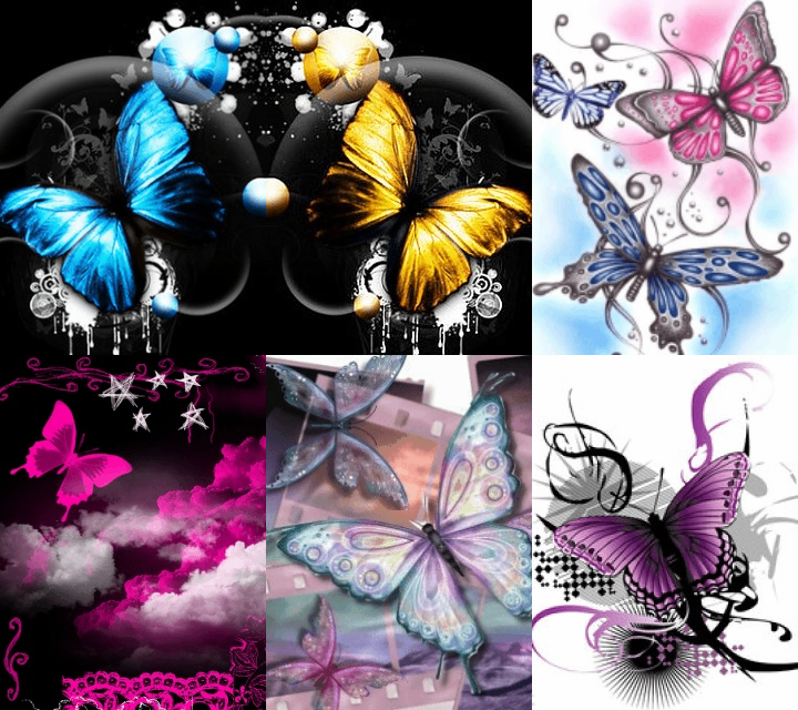
A butterfly is a mainly day-flying insect of the order Lepidoptera, which includes the butterflies and moths. Like other holometabolous insects, the butterfly's life cycle consists of four parts: egg, larva, pupa and adult. Most species are diurnal. Butterflies have large, often brightly coloured wings, and conspicuous, fluttering flight. Butterflies comprise the true butterflies (superfamily Papilionoidea), the skippers (superfamily Hesperioidea) and the moth-butterflies (superfamily Hedyloidea). All the many other families within the Lepidoptera are referred to as moths. The earliest known butterfly fossils date to the mid Eocene epoch, between 40–50 million years ago.
Butterflies exhibit polymorphism, mimicry and aposematism. Some, like the Monarch, will migrate over long distances. Some butterflies have evolved symbiotic and parasitic relationships with social insects such as ants. Some species are pests because in their larval stages they can damage domestic crops or trees; however, some species are agents of pollination of some plants, and caterpillars of a few butterflies (e.g., Harvesters) eat harmful insects. Culturally, butterflies are a popular motif in the visual and literary arts.